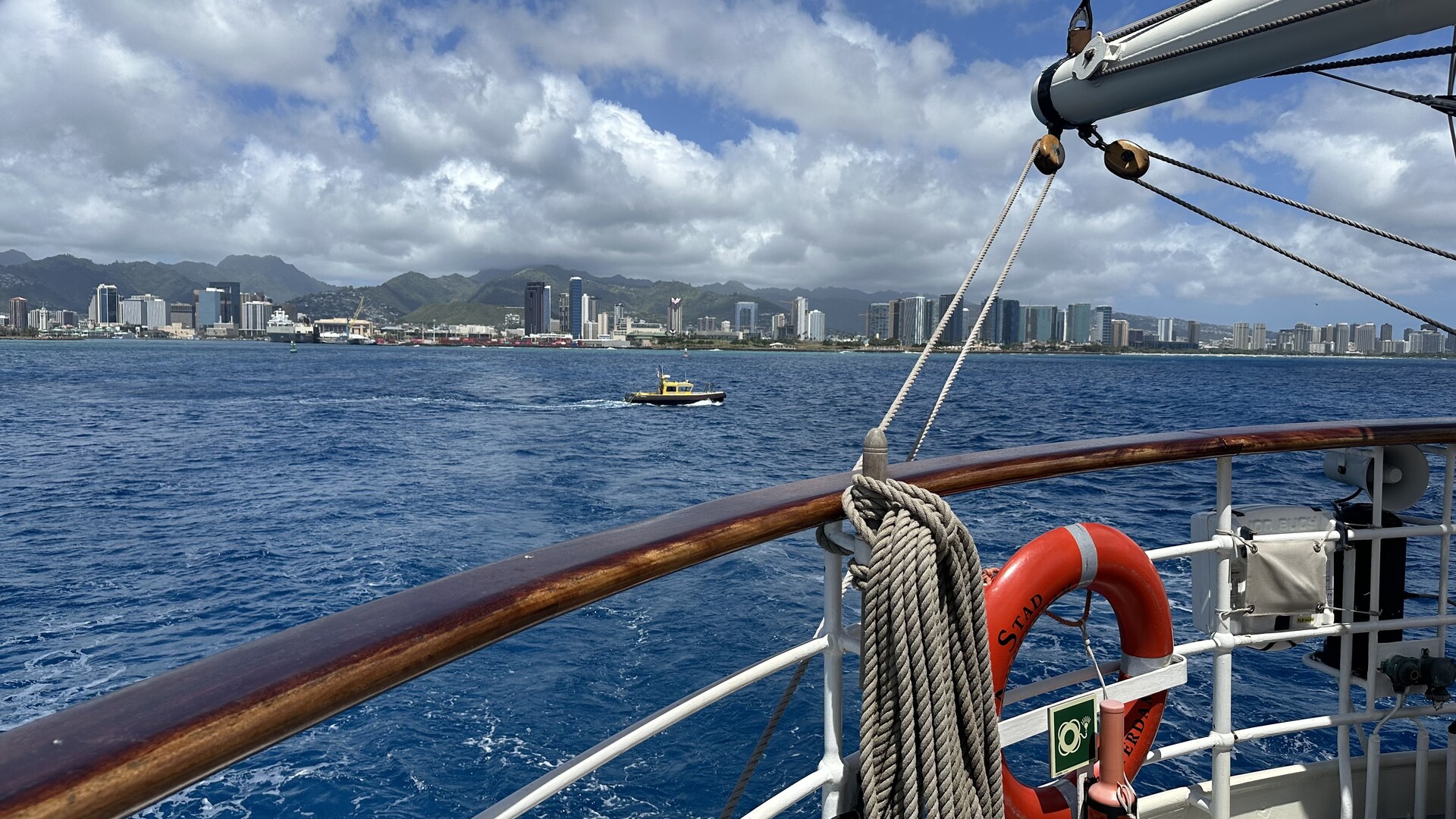
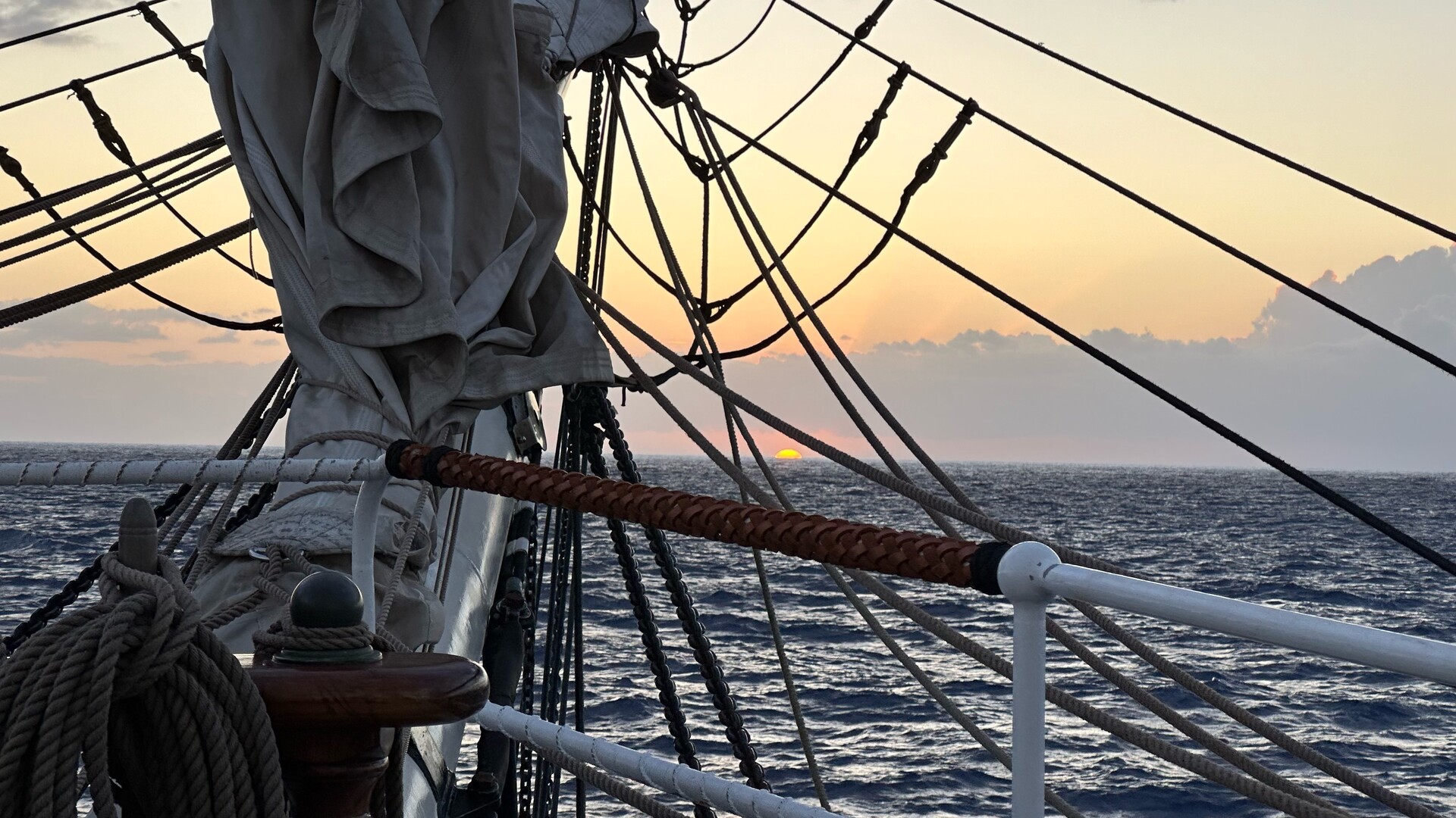
We’ve cast off lines and put Honolulu to our rudder. Soon we’ll leave Hawaii in our wake as we sail on towards Japan.
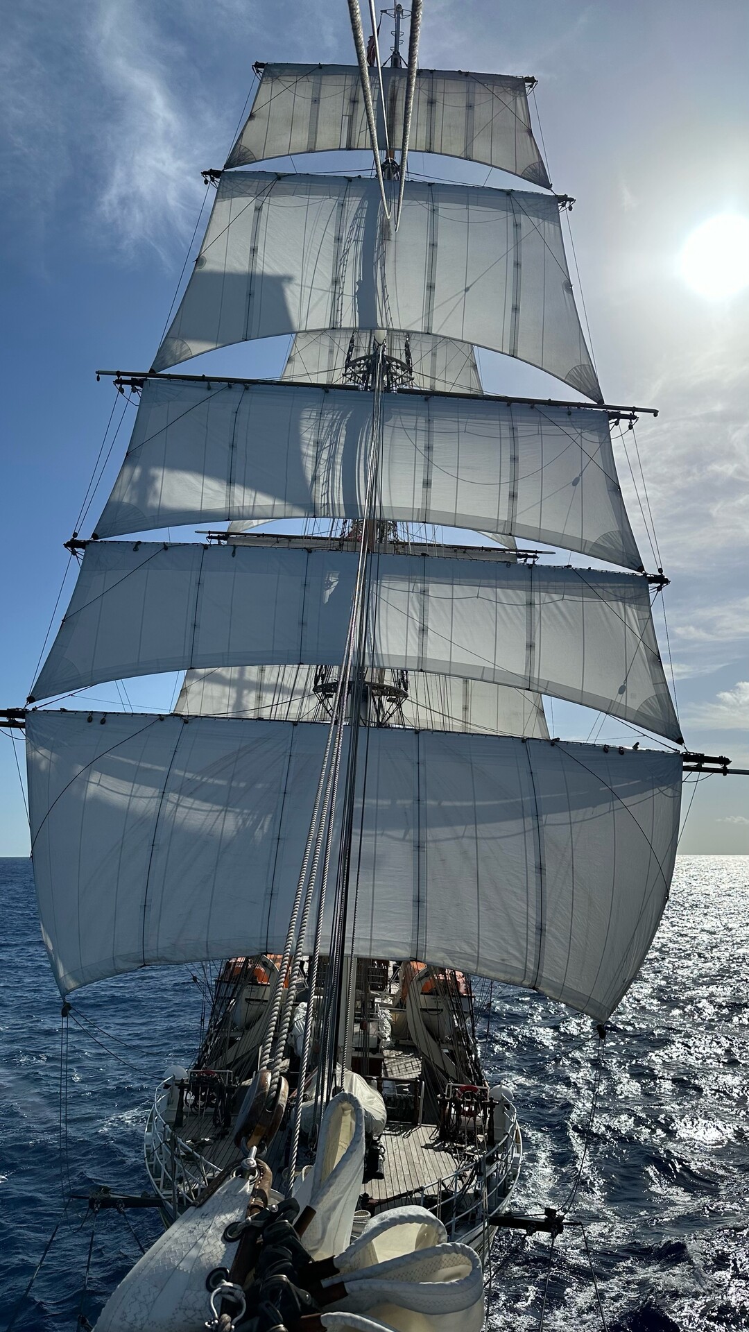
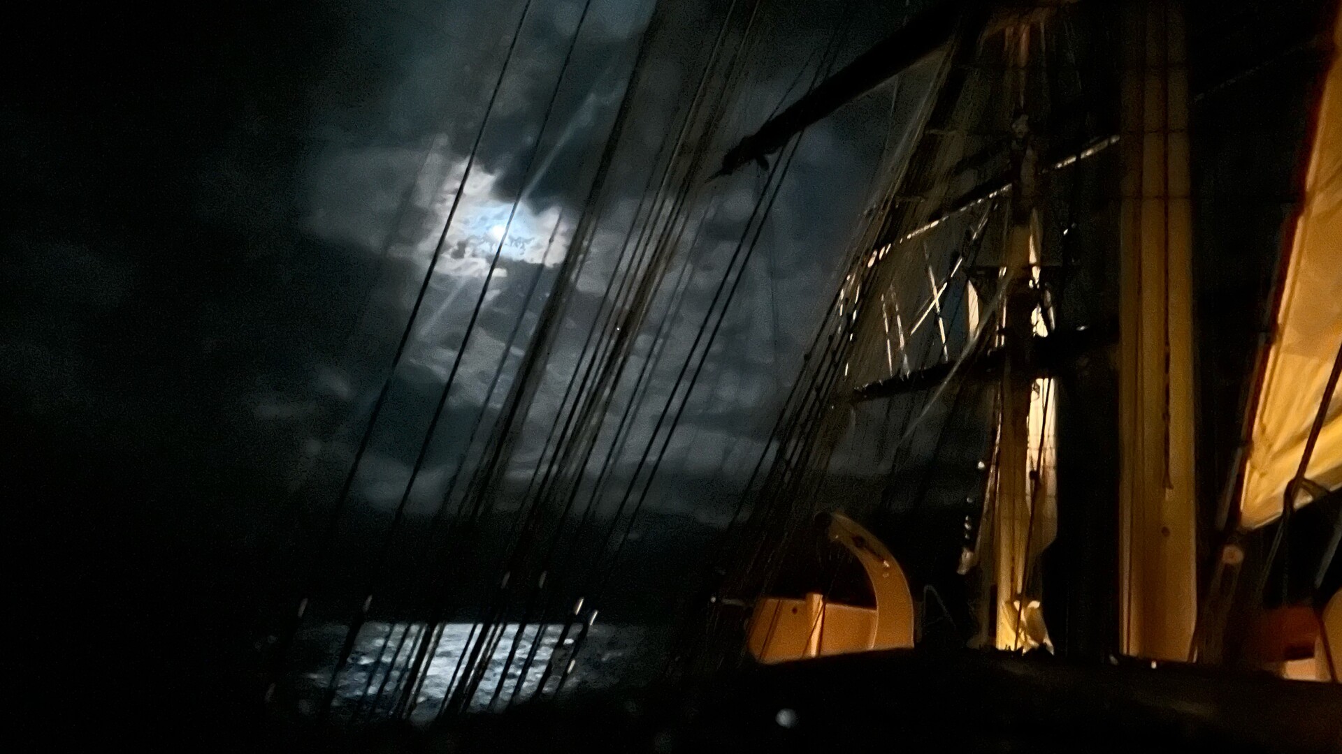
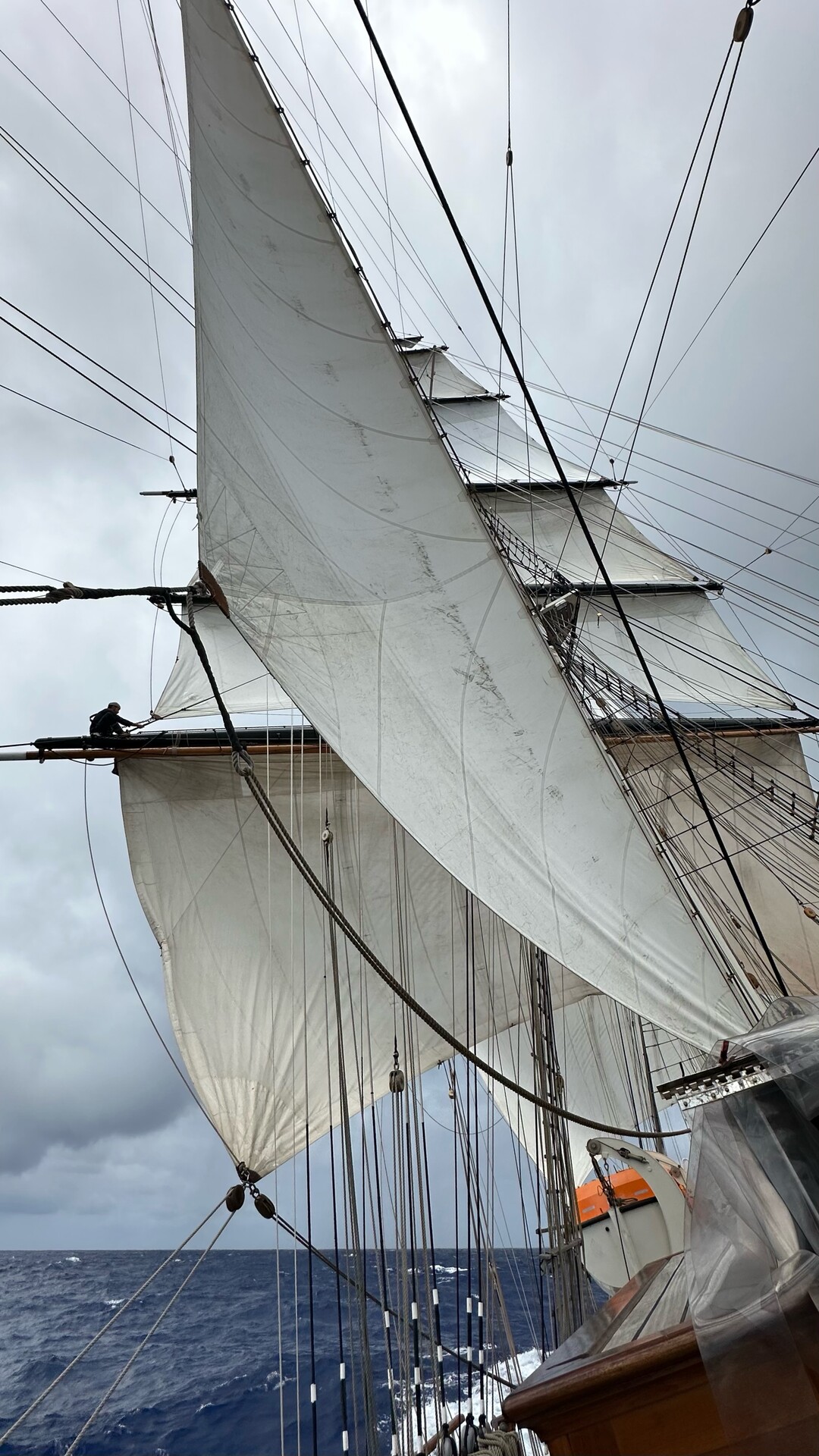
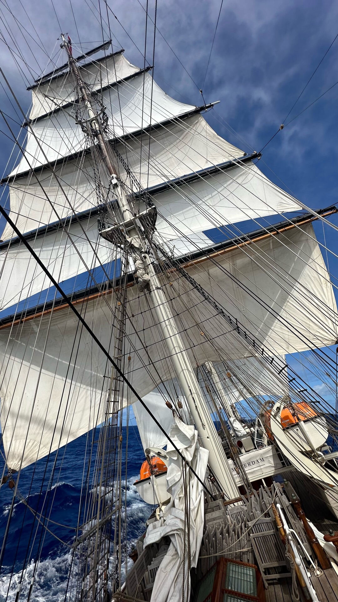
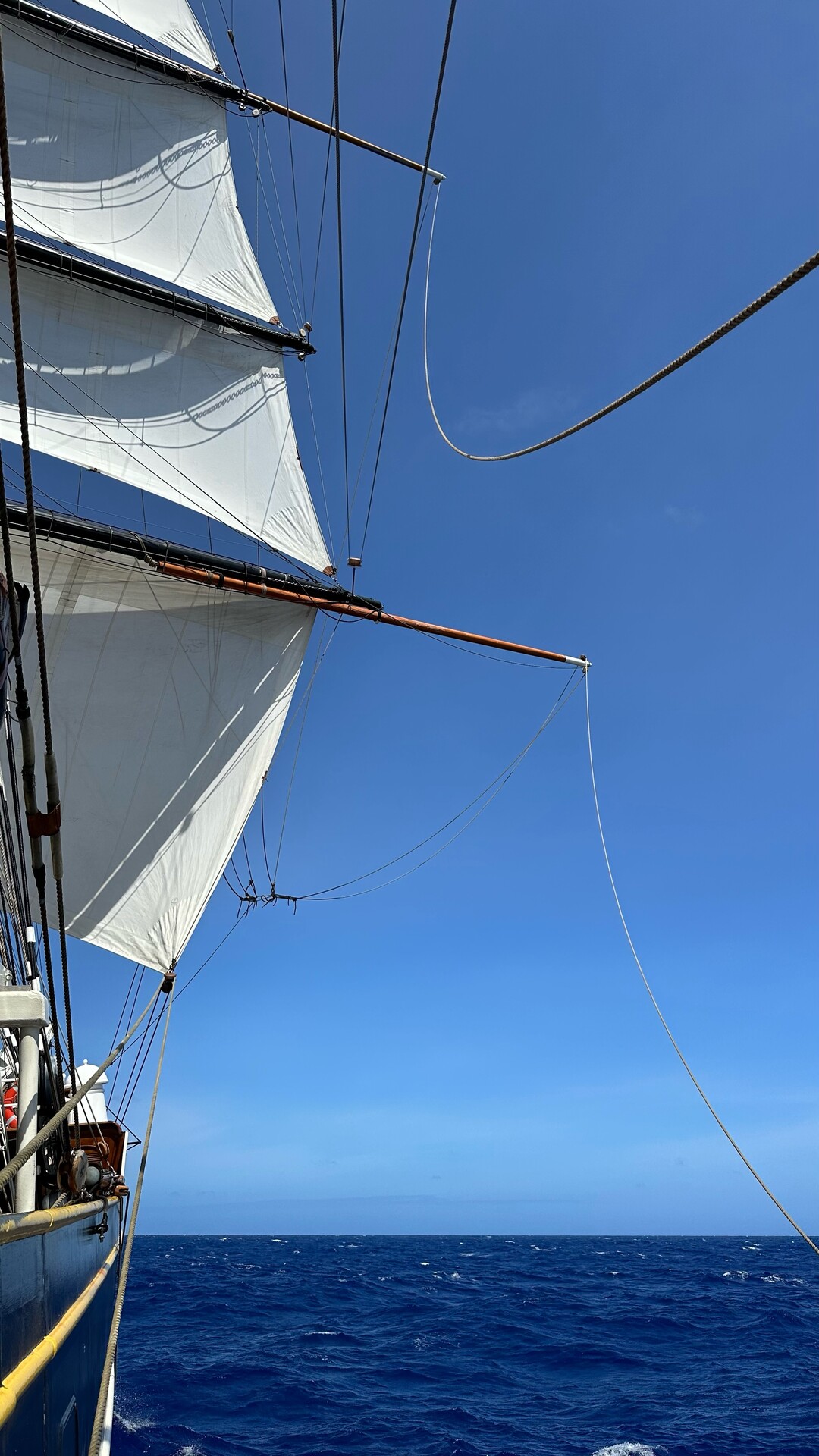
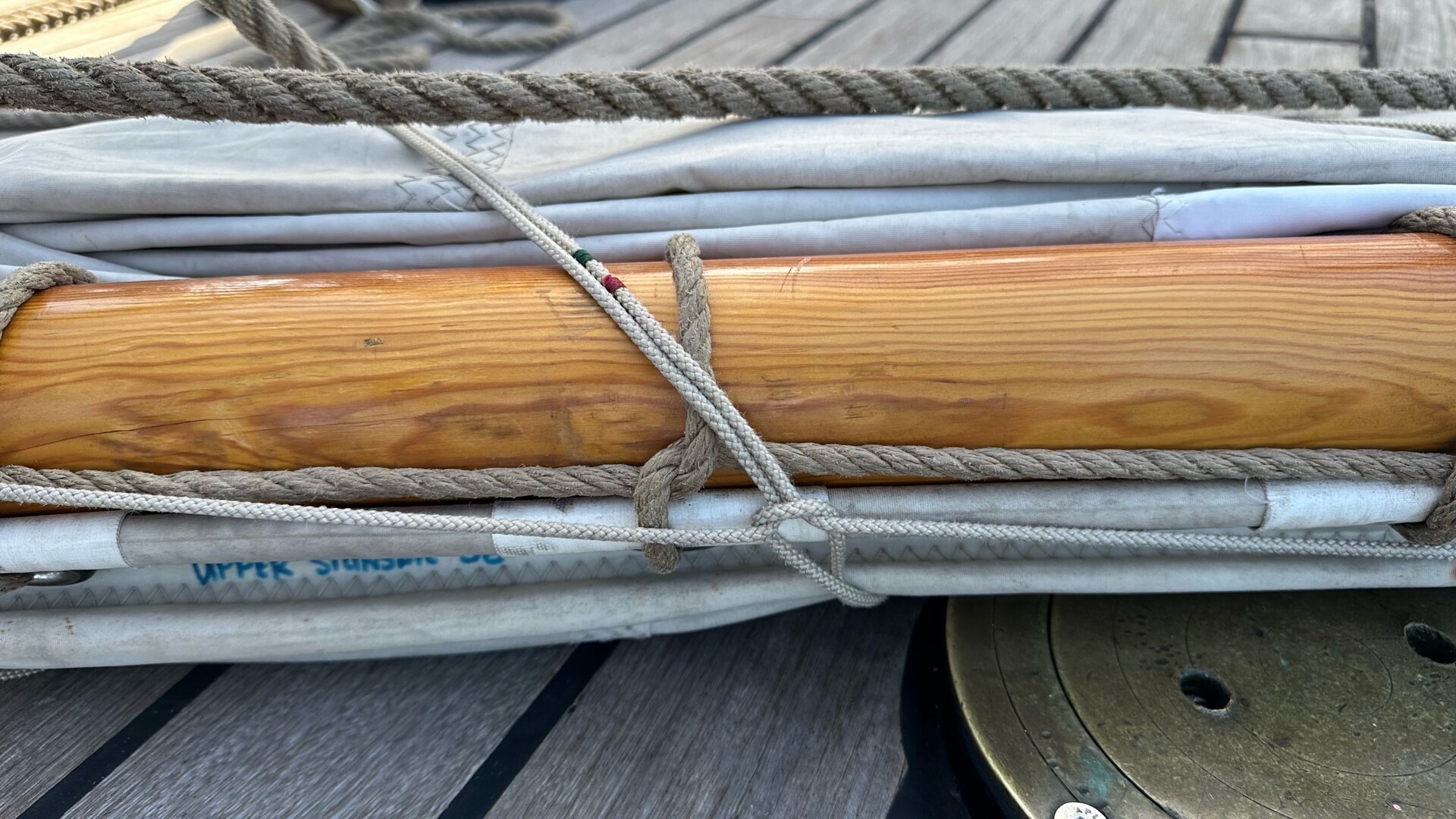
Winds have picked up so we doused and furled the main royal and sky sails and then hauled out the spanker on the mizzen.
We doused and sea stowed the main topgallant, royal and sky sail before bed, and the other watch unfurled them this morning.
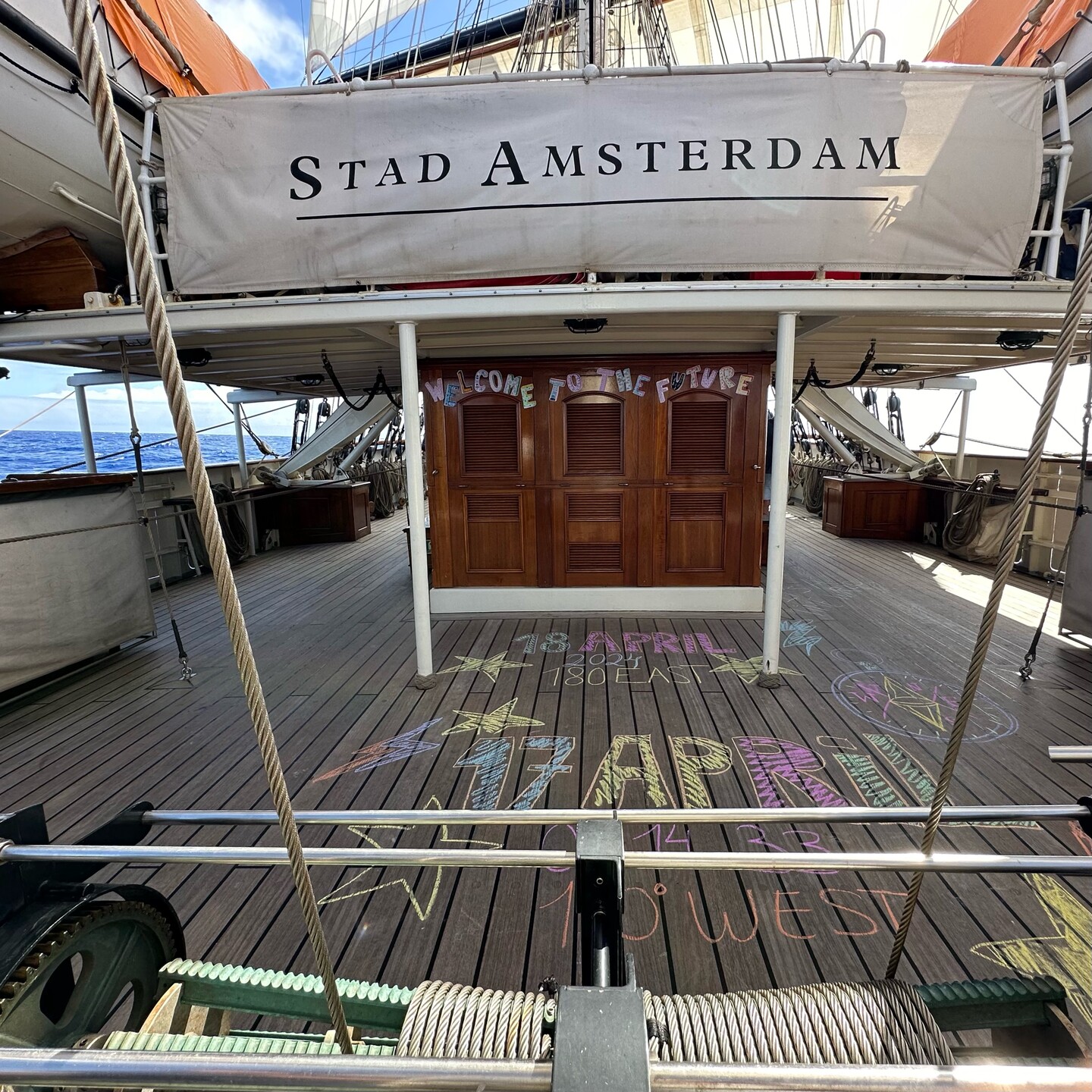
According to my calculations we crossed longitude 180 from west to east and have sailed into the future.
We have officially entered the Domain of the Golden Dragon and Wednesday is no more.
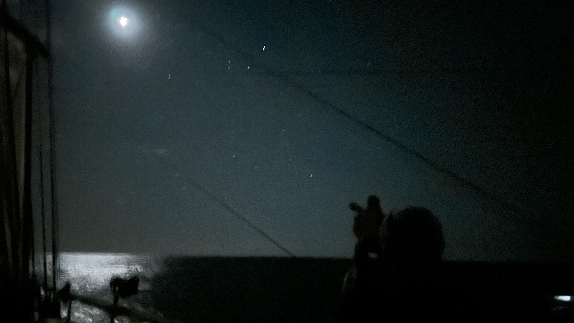
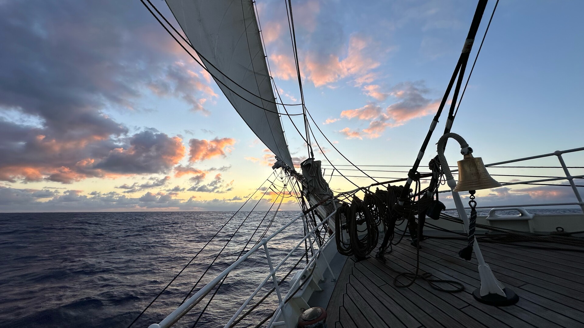
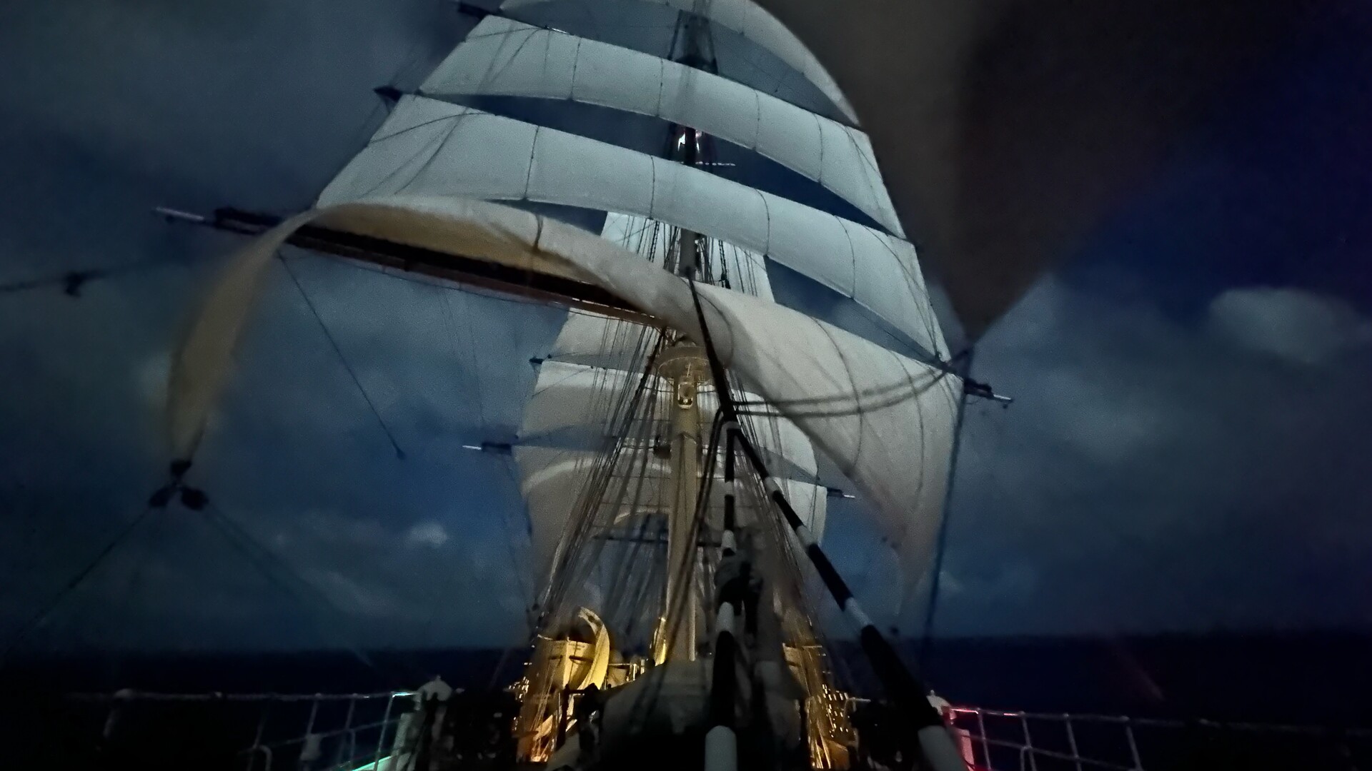
Wore ship and braced around. Now enjoying the quiet moonlight on the last lookout of this night watch.
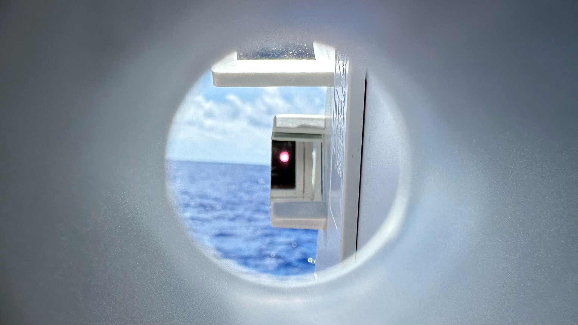
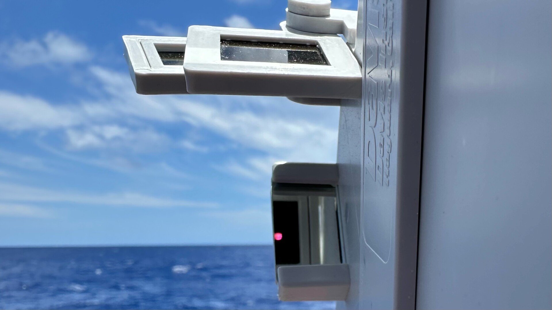
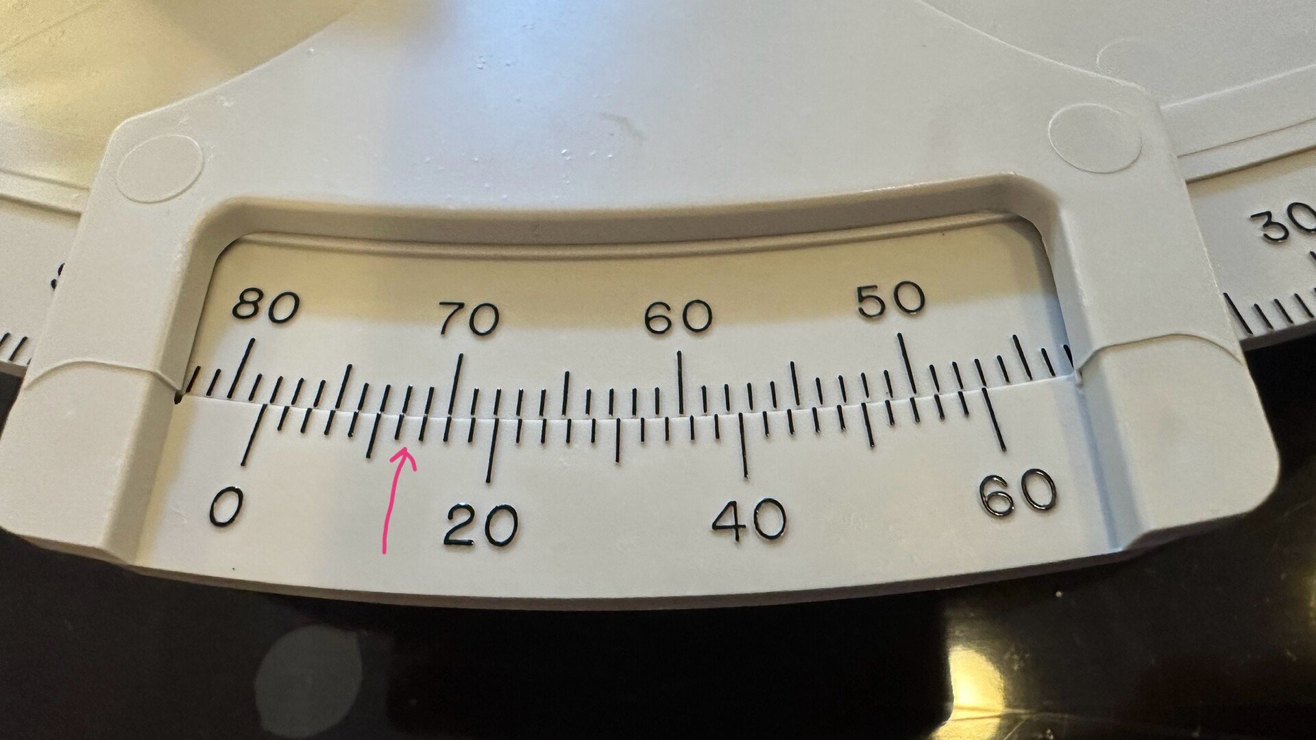
Love this beautiful and clear illustration of how a sextant works.

@th Sextanty!
Hmm. I see where one gets 78°.
(0 of outer scale aligns with 78 on inner scale.)
How do you all get 13' from this reading?
%- )
Hmm. If I see correctly, I think that the outer scale (0) is actually past 78. If one reads this like a vernier caliper, one then looks for where the outer & inner markings are "perfectly" aligned. Since the outer scale is marked at 2' intervals, I assume that the 12' & 14' marks are the most closely aligned. With 2 marks, one then interprets the average or 13'.
How close am I? %- )
@SaguaroLynx the vernier scale shows that the 12 and 14 lines almost align so I estimated between them. https://en.wikipedia.org/wiki/Vernier_scale

@SaguaroLynx @th Slide-Rule interpolation time :-)

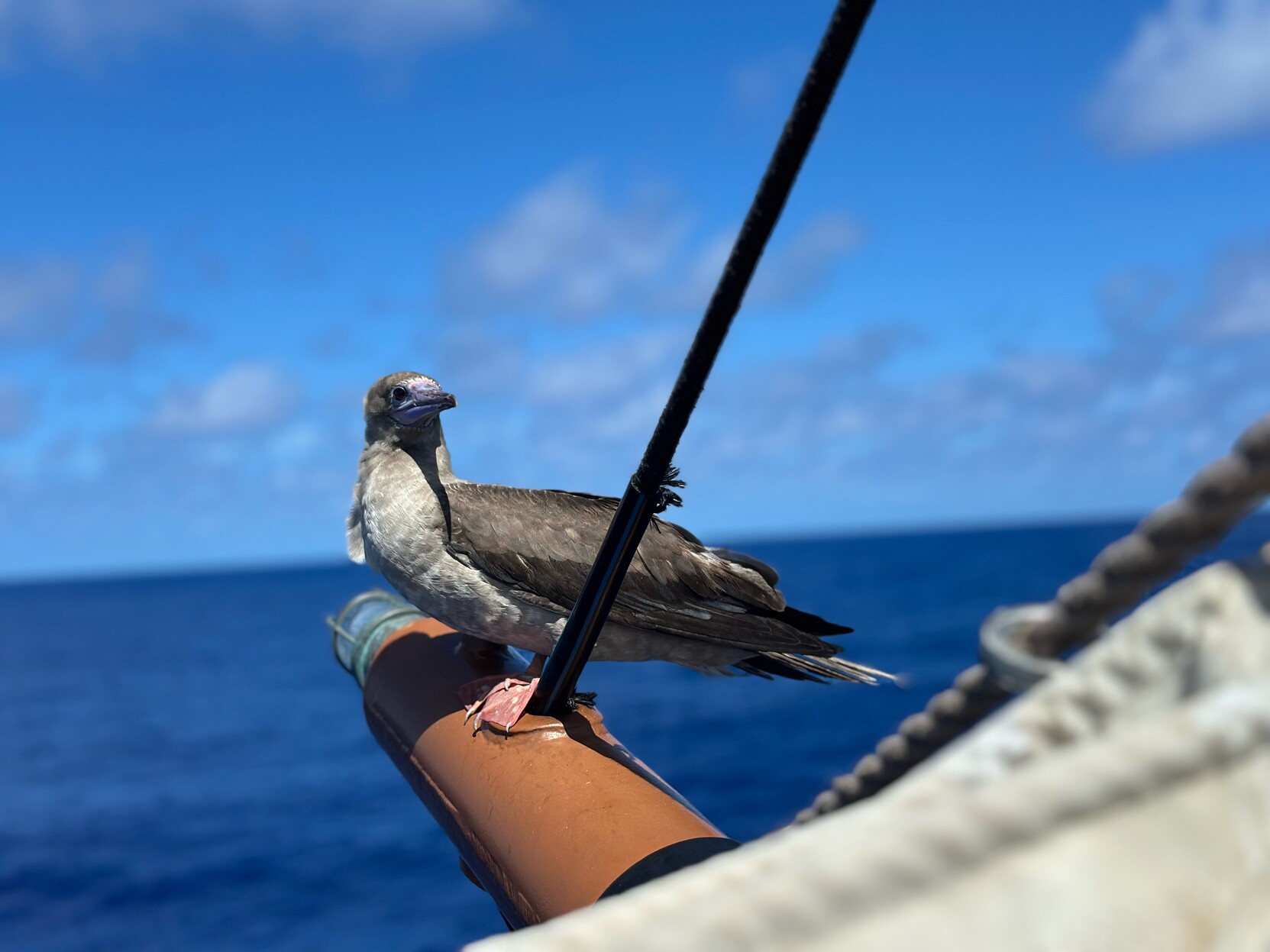
I always counted anything <10NM to be a win.

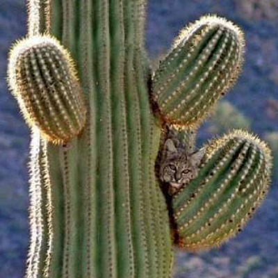
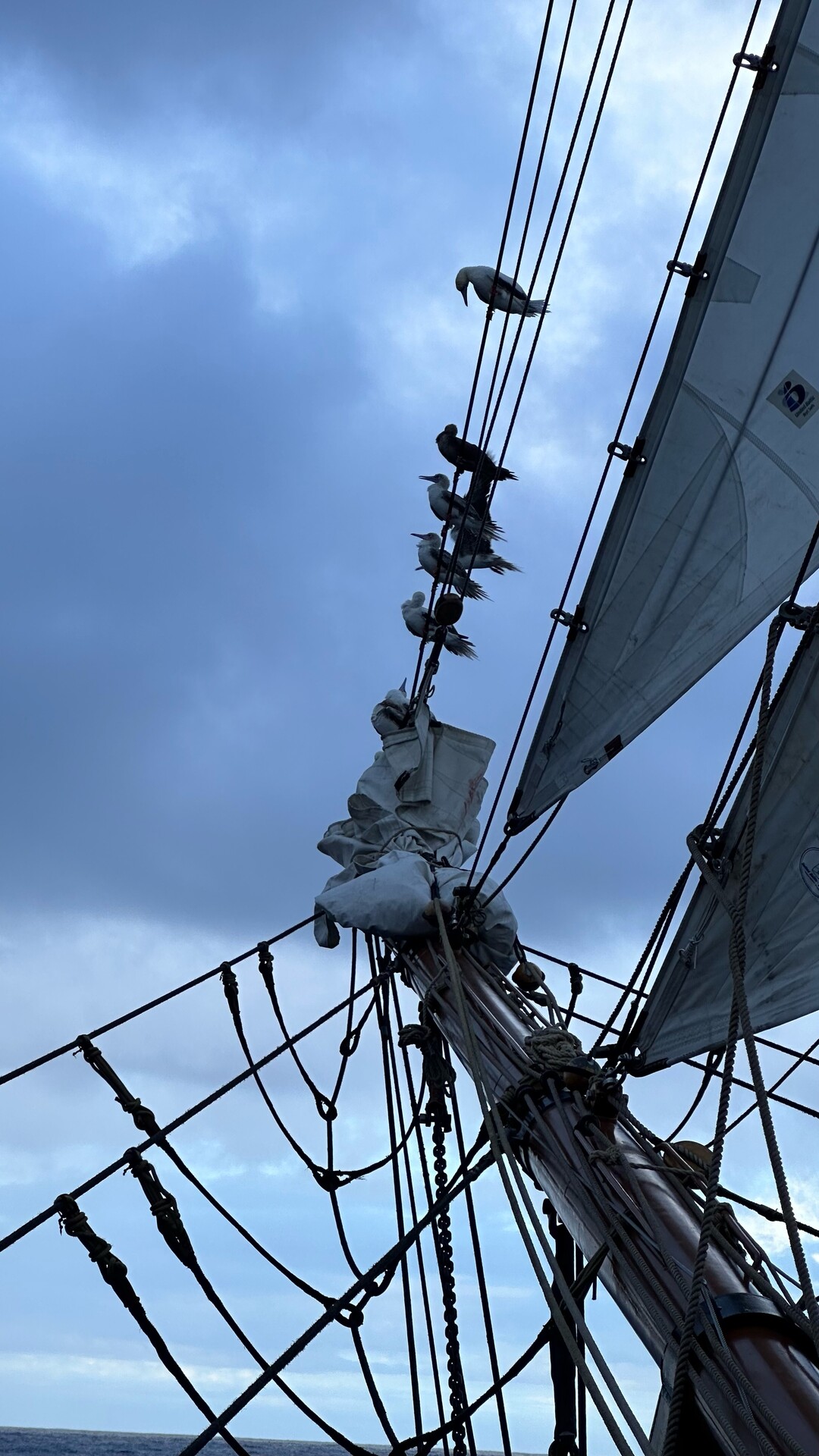
@th I thought that was a rabbit/cat at first, Great picture!
@th used to go sailing as a kid, though never on quite such a large watch. Would love to do it again though

@th is it better over there...?

If you cross the international date line from West to East, haven't you sailed back into yesterday? Considering your conveyance is also from there, perhaps it's for the best.

@th Former tall ship crew here...
I can hear this picture ;)

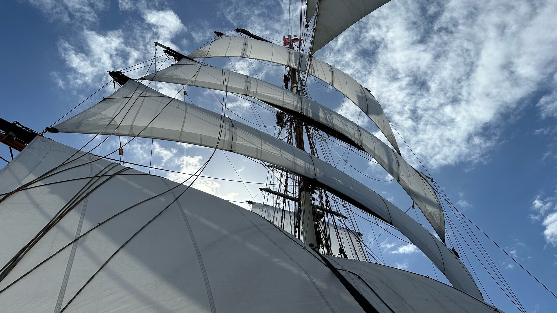
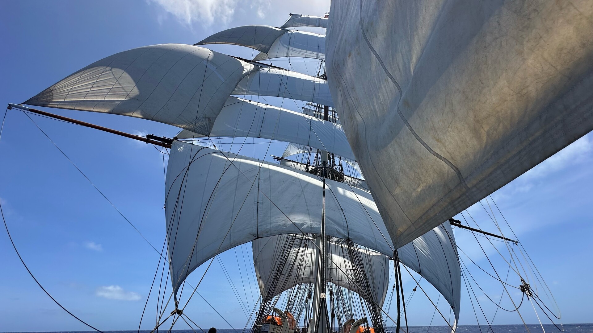
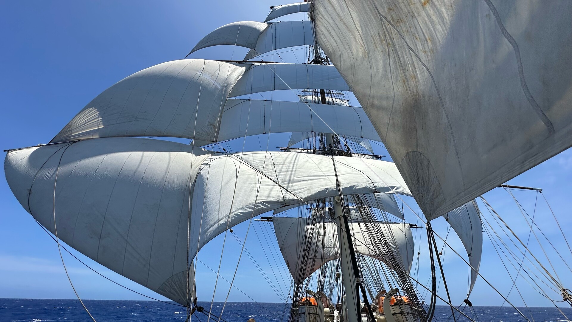
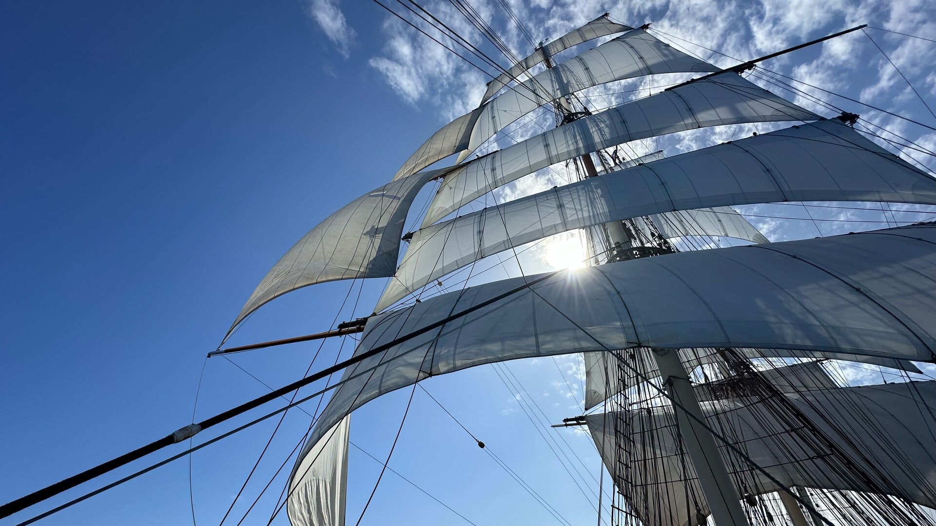
@th whoa sweet stuns'ls

@th All the sails!

@th that is sweet. Thanks for sharing. In the old days when ships were made of wood and men were made of steel we used to write the starboard cloud as the "stuns'ls".

@th
Gorgeous ship and gorgeous photos. Thanks for posting these!

Here @th 's story entices me to post more. Sights like these really strike the awe at the hearth of all
@th What're the tiny Port/Starboard bands visible at center? Markers for correlating to a specific sail?

@th this is so cool! Where can I find more information about your trip and the ship?

@asciijungle Unless I'm totally confused (not impossible) it's this:
https://en.wikipedia.org/wiki/Stad_Amsterdam
https://www.stadamsterdam.com/en/
https://www.stadamsterdam.com/en/world-tour-232425/
@th Is that land in the distance?
@th Sign me up for the press gang.
@th what sort of trip is that? Is it for tourists and they watch the crew do their work? Or do you climb up there yourself? 😮
It looks like an exciting adventure - thanks for sharing.

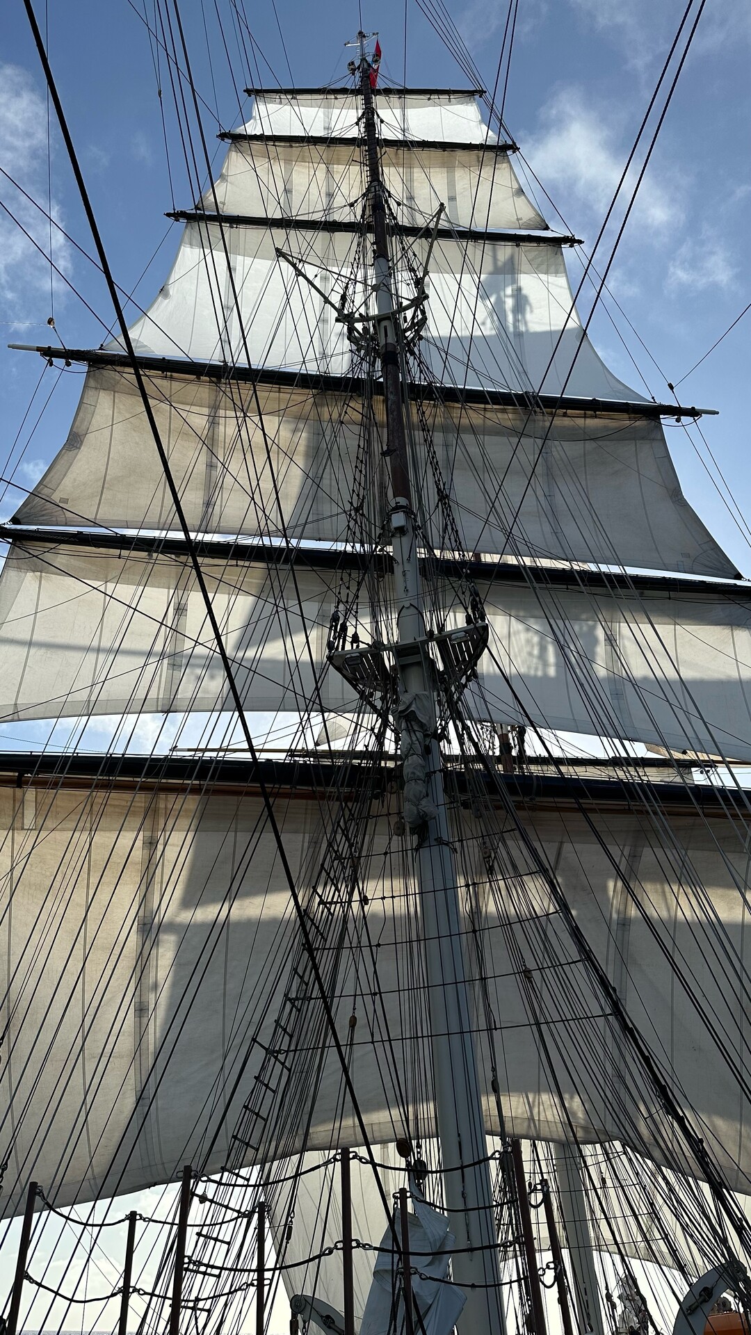
@th Sail names are a bit like x86 opcode names… 😅

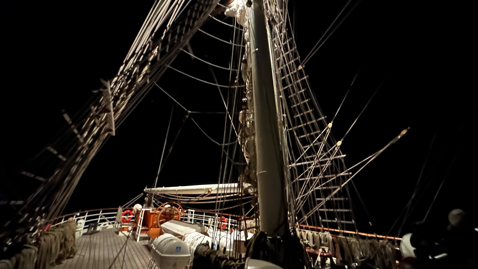
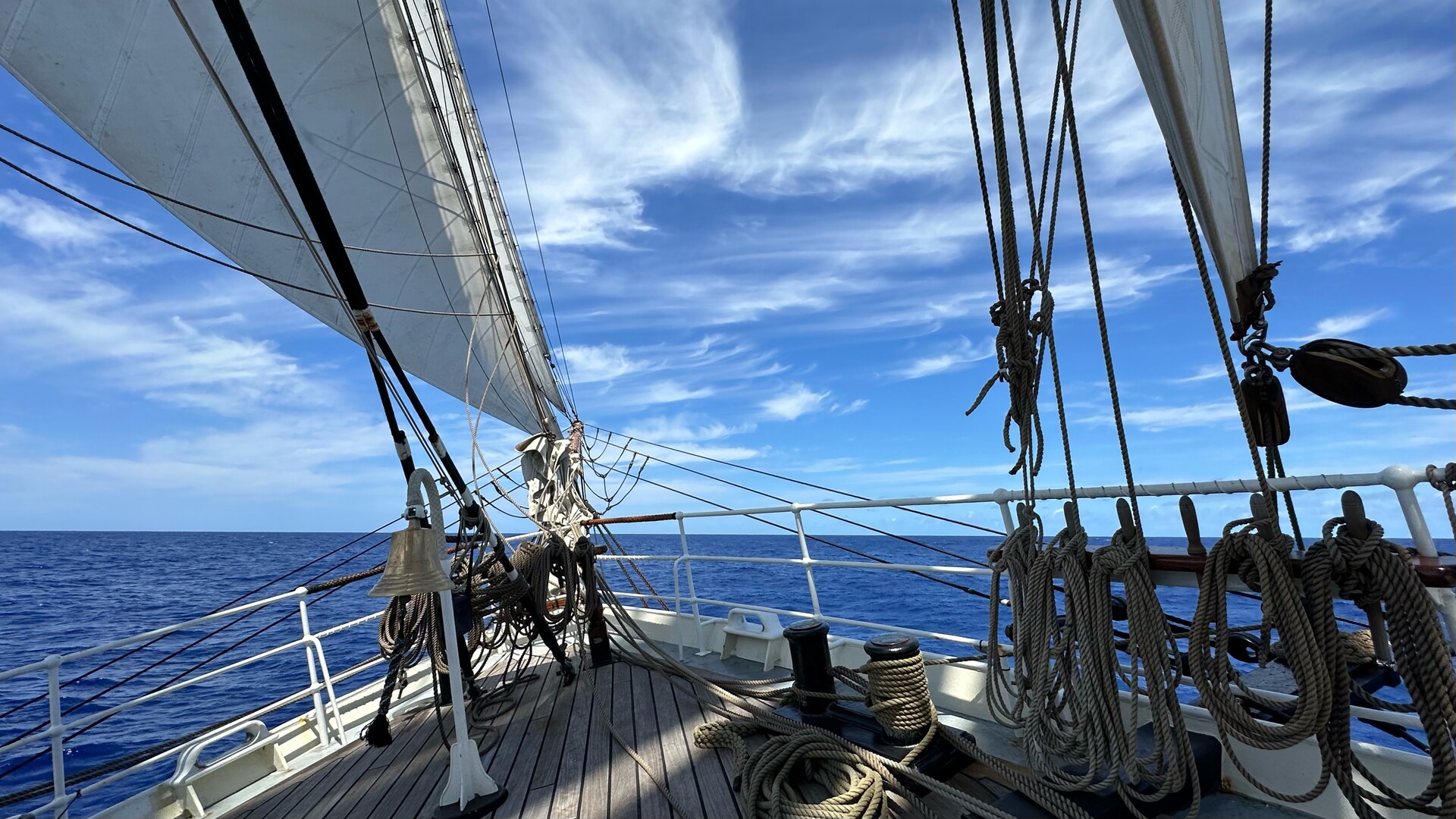
@th it's wild to me that the bell is on the bow.
@th ah, that makes sense! That's the main bell I suppose? Biggest ship I sailed was a ~40m barquentine, it only had the bell near the helm station.

Now THERE is a sentence we all wish we could utter once, unironically, in our lives.
"Winds have picked up so we doused and furled the main royal and sky sails and then hauled out the spanker on the mizzen."

@th That’s better than my one attempt, where I put us near the centre of Madrid. A look over the side suggested that as unlikely, because quite wet. Also, I could see Gibraltar.
I’d applied some of the corrections incorrectly.

@th
My son and I watched the eclipse through our SNO-T Russian sextant....
Oh how very cool! 8- )
I've long known that sextants are a powerful navigation tool.
Today, your photo helps show *how* it works!
IIUC, you adjust the upper "glass" (?) to align the image of the sun with the visible horizon.
If one does this at local "noon", then one can determine latitude. One then compares the local time with GMT/UTC to determine longitude.
Although surprising at first glance, the fact that the sextant is made from plastic has a bonus feature. Unlike brass sextants, plastic ones probably float, which is very useful if one's sextant somehow decides to take a "swim". :- o
Thanks for sharing your journeys!
:- )

@th Is there an online celestial navigation learning resource that you would recommend?
Meridian passage fix within a few NM of the ships GPS. (That’s nautical miles, not nanometers)